South America / Argentina

San Carlos de Bariloche.

Places to go. A little room to wander.

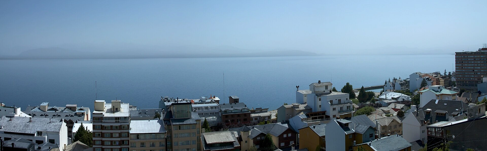
A local view near San Carlos de Bariloche, Argentina
A local view near San Carlos de Bariloche, Argentina. Photograph by McKay Savage from London, UK · CC BY 2.0 · Resized and converted to WebP.

THE SHORTLIST

A few places worth your time.

01Culture · DAY 1 IDEA

San Carlos de Bariloche

Cerro Otto

Viewpoint over the area of Bariloche. The rotating restaurant at the top has some impressive vistas of the region and there are some nice hiking trails behind the restaurant.

Allow about 90 minutes · planning estimate

Map Source
02Culture · DAY 1 IDEA

San Carlos de Bariloche

Huemul Project Site

In the early 1950s, an Austrian scientist named Ronald Richter attempted to build the world's first fusion power plant on an island in a lake in the Andes, the undertaking being known as the Huemul Project. As the patron of the project, President Juan Perón, was ousted in 1955, Richter was arrested for fraud.

Allow about 90 minutes · planning estimate

Map Source
03Culture · DAY 1 IDEA

Regional outing · 16 km from San Carlos de Bariloche (straight line)

Cerro Frey trek

Considered by many as the best 1-3 days trekking in Bariloche. When it's cold enough you can skate in the lake near the refuge. When there's not too much snow you can climb the granite "agujas" (needles) near the refuge which have ways for all levels, or head to Lago Jakob.

Allow about 90 minutes · planning estimate

Map Source
04Culture · DAY 2 IDEA

Regional outing · 23 km from San Carlos de Bariloche (straight line)

Cerro López

In late spring/summer/early autumn there's a trekking trail to the mountain shelter (not as easy as Otto's). It takes about 3 hours to get there and can be quite tiring, but the views from the shelter are impressive. Be sure to bring along water and some fruit to keep your energy. Colonia Suiza, a Swiss-like borough, is nearby.

Allow about 90 minutes · planning estimate

Map Source
05Outdoors · DAY 2 IDEA

Regional outing west of Bariloche

Cerro Campanario

A lake-and-mountain viewpoint west of the centre, reached as a separate excursion rather than a downtown stroll. Choose the ascent according to your mobility and the weather. Leave time to compare the lakes in the panorama instead of combining every Circuito Chico stop in a single rushed afternoon.

Allow about 60 minutes · planning estimate

Map Source

A note before you go. Treat Cerro Frey trek as a separate regional outing from San Carlos de Bariloche. Arrange the outward and return journey before adding another visit on that day. The suggested days are an editable grouping, not a timed tour. Visit allowances exclude transfers, meals and queues; confirm the exact entrance and current visiting arrangements for Cerro Campanario before setting off.

Reference material retrieved 2026-10-19. Suggested days and time allowances are editorial starting points. Check the linked visitor information for opening hours, access, and reservations.

BEFORE YOU SET OFF

A more practical kind of plan.

Getting your bearings

Excellent public bus service, served by just one company (since 2017): My Bus. The only exception is if you want to visit Dinahuapi, then you should catch a bus of "Las grutas". The bus uses the same "Sube" system used in Buenos Aires so your can pay with any contactless debit or credit card or with an official "Sube" card if you already have one. Confusingly, there is also another IC card in use in Bariloche, e.g. to go by bus to Dina Huapi northeast of Bariloche. This one is called Solución.

Build a route that makes sense

Cerro Otto and Huemul Project Site are about 4.6 km apart in a straight line. Use the route link to compare the actual streets or transport connections before putting both in the same morning; the measurement is not a walking distance or a transfer estimate.

A LITTLE STRUCTURE. ROOM FOR DISCOVERY.

Your San Carlos de Bariloche plan.

Add a few stops, choose your days, and leave space between them.

My saved trips
Location, map & reference details

Find your bearings.

Country
Argentina
Area
Rio Negro
Time zone
America/Argentina/Salta
Coordinates
-41.1456, -71.3082

Geographic reference: GeoNames, CC BY 4.0.

San Carlos de Bariloche

Loading this map connects to OpenStreetMap.

Visitor information & sources

Reference credits & reuse

This city guide includes selected, abridged material by Wikivoyage contributors, adapted under CC BY-SA 4.0. The adapted guide text is available under the same license; photographs and website design retain their separate terms. Selected and abridged reference descriptions; operational prices and timetables omitted. Elsewhere added the shortlist, geographic grouping and planning notes.

Reference material retrieved 2026-10-19. It is community-edited background, not firsthand reporting or a live opening-hours service.

KEEP EXPLORING

More places in Argentina.

Browse the country
A WORLD OF POSSIBILITIES

Where to next?

Search 600 places across 100 countries.