South America / Ecuador

Guayaquil.

Places to go. A little room to wander.

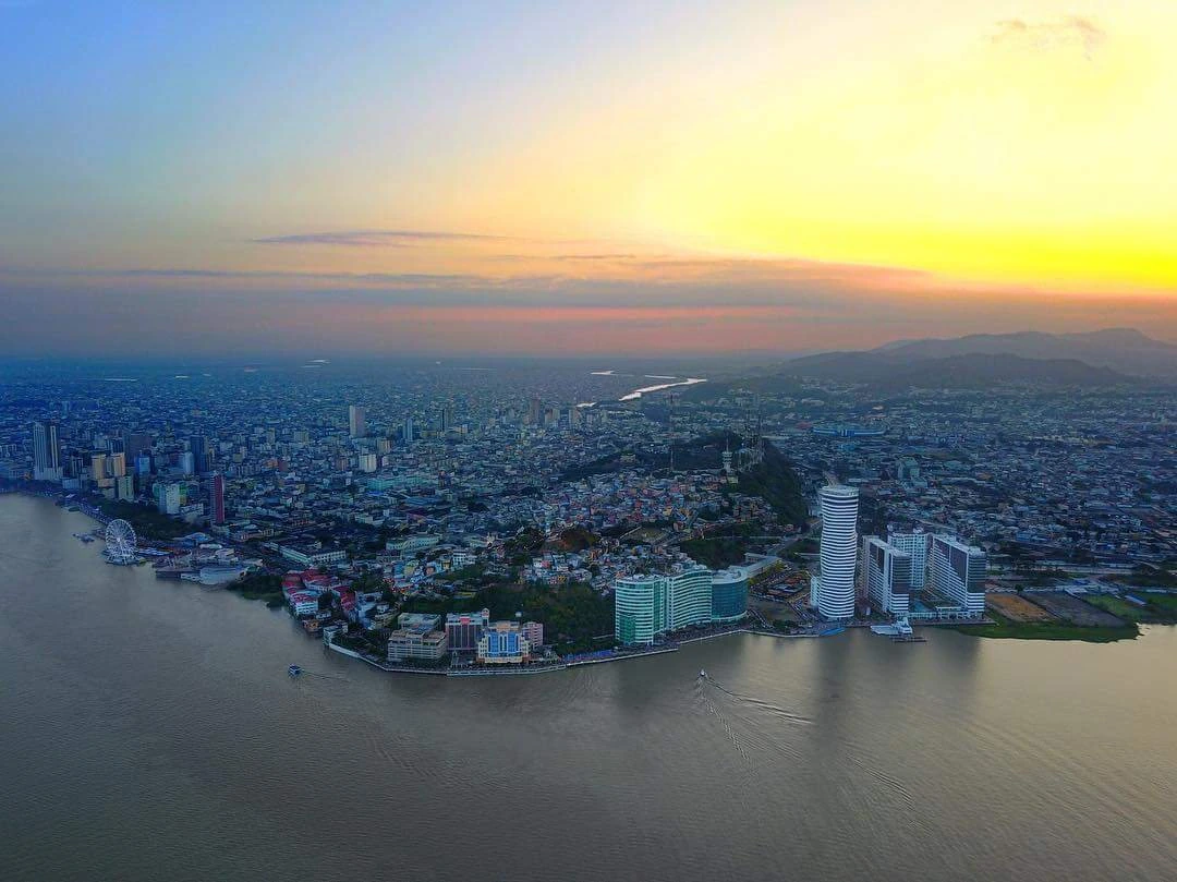
A local view near Guayaquil, Ecuador
A local view near Guayaquil, Ecuador. Photograph by JorgeAlejanDroo · CC BY-SA 4.0 · Resized and converted to WebP.

THE SHORTLIST

A few places worth your time.

01Culture · DAY 1 IDEA

Guayaquil

Las Peñas

, where the city was founded, has been rebuilt and painted bright colors where most of Guayaquil's colonial buildings are.You can walk up the 400-odd steps lined with ice cream and snack vendors to the top from the Malecon Simón Bolivar (northern end of Malecon 2000), where you'll find a lighthouse called , museum called Museo El Fortín, and chapel called Iglesia del Cerro Santa Ana.

Allow about 90 minutes · planning estimate

Map Source
02Outdoors · DAY 1 IDEA

Guayaquil

Santa Ana & El Carmen hills

. You can see almost the whole city from here, particularly from the or

Allow about 60 minutes · planning estimate

Map Source
03Outdoors · DAY 2 IDEA

Regional outing · 23 km from Guayaquil (straight line)

El Lago Park

Kind of a swampy ecopark where you can see birds and other terrestrial critters.

Allow about 60 minutes · planning estimate

Map Source

A note before you go. Treat El Lago Park as a separate regional outing from Guayaquil. Arrange the outward and return journey before adding another visit on that day. The suggested days are an editable grouping, not a timed tour. Visit allowances exclude transfers, meals and queues; confirm the exact entrance and current visiting arrangements for El Lago Park before setting off.

Reference material retrieved 2026-10-19. Suggested days and time allowances are editorial starting points. Check the linked visitor information for opening hours, access, and reservations.

BEFORE YOU SET OFF

A more practical kind of plan.

Getting your bearings

Metrovía is a modern bus rapid transit (BRT) system that runs mostly from north to south and east to west of the city. You can use either cash or an electronic card (la Tarjeta Metrovía) to pay. It is a reliable and easy-to-navigate transport system; has modern buses and stops. It offers a good connection between downtown and to the main bus terminal and the airport. The Rio Daule terminal is across the street from the main bus terminal and some blocks away (around 15 minutes walking) from the airport. Match the code of the bus (e.g.

Build a route that makes sense

Keep Las Peñas as the anchor for one day and El Lago Park for the other. Check their exact entrances on the map before adding further stops; a town name alone is not a reliable meeting point.

A LITTLE STRUCTURE. ROOM FOR DISCOVERY.

Your Guayaquil plan.

Add a few stops, choose your days, and leave space between them.

My saved trips
Location, map & reference details

Find your bearings.

Country
Ecuador
Area
Guayas
Time zone
America/Guayaquil
Coordinates
-2.1962, -79.8862

Geographic reference: GeoNames, CC BY 4.0.

Guayaquil

Loading this map connects to OpenStreetMap.

Visitor information & sources

Reference credits & reuse

This city guide includes selected, abridged material by Wikivoyage contributors, adapted under CC BY-SA 4.0. The adapted guide text is available under the same license; photographs and website design retain their separate terms. Selected and abridged reference descriptions; operational prices and timetables omitted. Elsewhere added the shortlist, geographic grouping and planning notes.

Reference material retrieved 2026-10-19. It is community-edited background, not firsthand reporting or a live opening-hours service.

KEEP EXPLORING

More places in Ecuador.

Browse the country
A WORLD OF POSSIBILITIES

Where to next?

Search 600 places across 100 countries.