Asia / Oman

Sohar.

Places to go. A little room to wander.

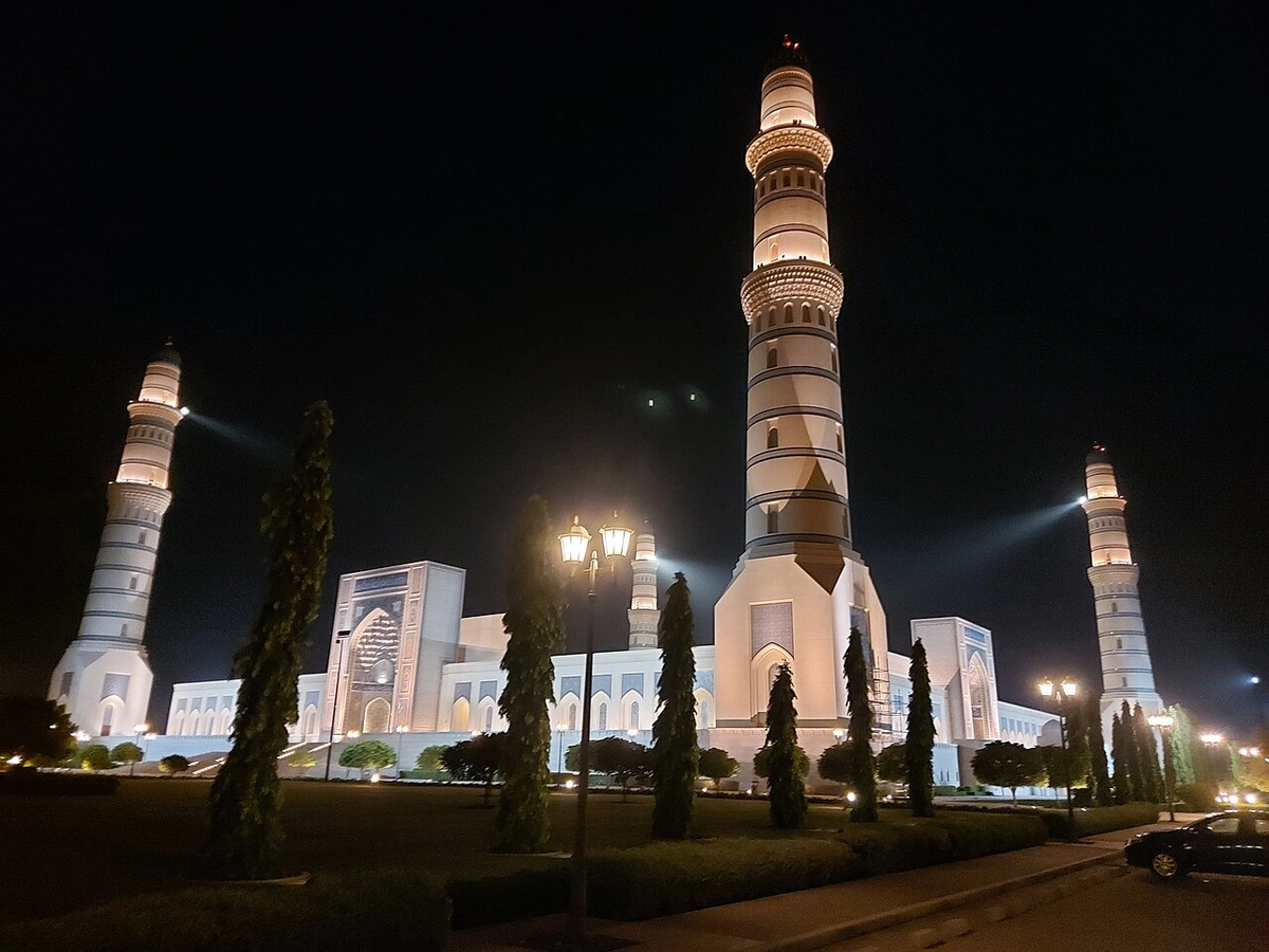
A local view near Sohar, Oman
A local view near Sohar, Oman. Photograph by Mohammed j2 · CC BY-SA 4.0 · Resized proportionally to at most 1200 pixels wide without upscaling or a height limit; original ICC retained; EXIF orientation applied; converted to WebP high-quality photographic compression.

THE SHORTLIST

A few places worth your time.

01Culture · DAY 1 IDEA

Sultan Qaboos Rd

Sohar Fort and Museum

One of the most prominent features in the city of Sohar and was built between the 13th and 14th centuries CE by the 'Emirs of Hormuz'. Imam Nasser bin Murshid Al Ya'arubi managed to conquer and expel the Portuguese from the castle, which was used since then as the administration centre for the rulers of Al-Bu Said dynasty. An escape tunnel runs from inside the fort to the Wilayat of Buraimi, 10 km to the west. It was used as a route to obtain reinforcements and supplies during sieges.

Allow about 90 minutes · planning estimate

Map Source
02Food · DAY 1 IDEA

Al Bahri Rd (Corniche)

Fish market

A good place to watch fisherman unload the catch of the day.

Allow about 60 minutes · planning estimate

Map Source
03Culture · DAY 2 IDEA

Regional outing · 21 km from Sohar (straight line)

Hawra Burghah Fortress

A ruined 13th-century hilltop fortress with commanding views of the wadi and neighboring area. The hill can be climbed most easily from the north, and there are extensive remains of cisterns and falaj (canals), indicating that this was once covered with lush vegetation.

Allow about 90 minutes · planning estimate

Map Source

A note before you go. Treat Hawra Burghah Fortress as a separate regional outing from Sohar. Arrange the outward and return journey before adding another visit on that day. The suggested days are an editable grouping, not a timed tour. Visit allowances exclude transfers, meals and queues; confirm the exact entrance and current visiting arrangements for Hawra Burghah Fortress before setting off.

Reference material retrieved 2026-10-19. Suggested days and time allowances are editorial starting points. Check the linked visitor information for opening hours, access, and reservations.

BEFORE YOU SET OFF

A more practical kind of plan.

Build a route that makes sense

Sohar Fort and Museum and Fish market are about 2.0 km apart in a straight line. Use the route link to compare the actual streets or transport connections before putting both in the same morning; the measurement is not a walking distance or a transfer estimate.

A LITTLE STRUCTURE. ROOM FOR DISCOVERY.

Your Sohar plan.

Add a few stops, choose your days, and leave space between them.

My saved trips
Location, map & reference details

Find your bearings.

Country
Oman
Area
Al Batinah North
Time zone
Asia/Muscat
Coordinates
24.3474, 56.7094

Geographic reference: GeoNames, CC BY 4.0.

Sohar

Loading this map connects to OpenStreetMap.

Visitor information & sources

Reference credits & reuse

This city guide includes selected, abridged material by Wikivoyage contributors, adapted under CC BY-SA 4.0. The adapted guide text is available under the same license; photographs and website design retain their separate terms. Selected and abridged reference descriptions; operational prices and timetables omitted. Elsewhere added the shortlist, geographic grouping and planning notes.

Reference material retrieved 2026-10-19. It is community-edited background, not firsthand reporting or a live opening-hours service.

KEEP EXPLORING

More places in Oman.

Browse the country
A WORLD OF POSSIBILITIES

Where to next?

Search 600 places across 100 countries.