Europe / The Netherlands

Rotterdam.

Places to go. A little room to wander.

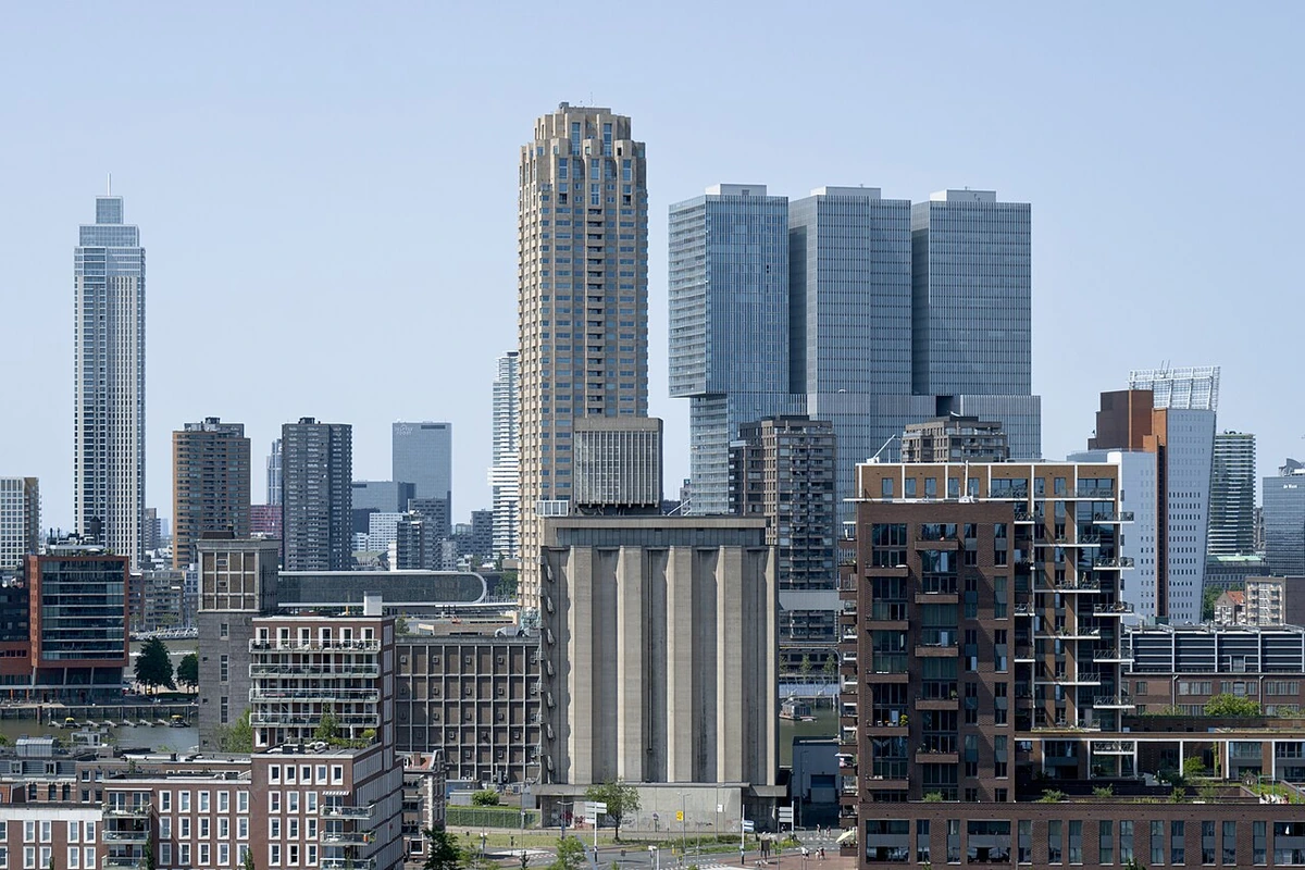
A local view near Rotterdam, The Netherlands
A local view near Rotterdam, The Netherlands. Photograph by Rob Oo · CC BY 2.0 · Resized proportionally, EXIF orientation applied, converted to high-quality WebP (quality 92); no content edits.

THE SHORTLIST

A few places worth your time.

01Culture · DAY 1 IDEA

Coolsingel 40

City Hall

The Rotterdam City Hall may appear quite historic compared to the modern outlook of the city, but it was actually only built in 1915 in a lavish style echoing historic city halls in other Dutch cities. Remarkably, the City Hall survived the bombing and is one of the few truly historic buildings in the city. It is nice to walk into the monumental main hall and see the statues. The courtyard is also worth a look.

Allow about 90 minutes · planning estimate

Map Source
02Culture · DAY 1 IDEA

Parklaan 30

Maastunnel (northern entrance)

The Maastunnel, built between 1937 and 1942, is the first Dutch tunnel to be built using the 'sunken tube' method, in which prefabricated elements are sunk down into the river to form the tunnel structure. The long tunnel allows for both car traffic and pedestrian and cyclist access. The two categories having separate tunnels. On site, bikes can be rented to make the journey into Charlois quicker.

Allow about 90 minutes · planning estimate

Map Source
03Culture · DAY 1 IDEA

Prinsenlaan

Vierkant Eiland in de Plas

The Vierkant Eiland in de Plas (Square Island in the Puddle) is a 1996 artwork by Frans de Wit. It symbolises the lowest point of the Netherlands (which is actually in Nieuwerkerk aan den IJssel), some below mean sea level. The island, measuring in both directions, has a deep concrete bowl in the middle of it and is connected to the mainland through two long bridges.

Allow about 90 minutes · planning estimate

Map Source
04Culture · DAY 2 IDEA

Nieuwe Laan 11

Dief- en Duifhuisje

A small house from 1612 that used to accompany the Capelle castle. The house has a quirky combination of functions, being used to house up to two prisoners on its ground floor, and housing carrier pigeons in its attic. It was used in this capacity until the sometime in the 19th century, and is nowadays considered the smallest museum of the Netherlands.

Allow about 90 minutes · planning estimate

Map Source
05Outdoors · DAY 2 IDEA

Rotterdam

Het Park

Quite literally translating to The Park, Het Park is the second-oldest park of Rotterdam, and the oldest within the city centre. Initially purchased by the city to build a new city hall, it was eventually decided to become a public space in 1852. The park was constructed in the style of the English landscape park in 1852. The park was then expanded with the purchase of an estate in 1875, and completed with the terrace on the river in 1898.

Allow about 60 minutes · planning estimate

Map Source

A note before you go. Start with City Hall, then decide whether Maastunnel (northern entrance) deserves a separate visit rather than rushing both. The suggested days are an editable grouping, not a timed tour. Visit allowances exclude transfers, meals and queues; confirm the exact entrance and current visiting arrangements for Het Park before setting off.

Reference material retrieved 2026-10-19. Suggested days and time allowances are editorial starting points. Check the linked visitor information for opening hours, access, and reservations.

BEFORE YOU SET OFF

A more practical kind of plan.

Getting your bearings

RET operates the buses, trams, and metro within the city. You could find a journey planner and some network maps there. Alternatively you'd use the pan-Netherlands journey planner – 9292.nl. Transport generally arrives every 10 minutes during the day. Free Wi-Fi is available in some trams, buses and metro lines, and on the busier metro stations, you just need to accept the terms of use. This system is called OV-Pay and is the most convenient way to travel. As anywhere else in the country OV-chipkaart can still be used to pay all kinds of public transport.

Build a route that makes sense

City Hall and Maastunnel (northern entrance) are about 2.4 km apart in a straight line. Use the route link to compare the actual streets or transport connections before putting both in the same morning; the measurement is not a walking distance or a transfer estimate.

A LITTLE STRUCTURE. ROOM FOR DISCOVERY.

Your Rotterdam plan.

Add a few stops, choose your days, and leave space between them.

My saved trips
Location, map & reference details

Find your bearings.

Area
South Holland
Time zone
Europe/Amsterdam
Coordinates
51.9225, 4.4792

Geographic reference: GeoNames, CC BY 4.0.

Rotterdam

Loading this map connects to OpenStreetMap.

Visitor information & sources

Reference credits & reuse

This city guide includes selected, abridged material by Wikivoyage contributors, adapted under CC BY-SA 4.0. The adapted guide text is available under the same license; photographs and website design retain their separate terms. Selected and abridged reference descriptions; operational prices and timetables omitted. Elsewhere added the shortlist, geographic grouping and planning notes.

Reference material retrieved 2026-10-19. It is community-edited background, not firsthand reporting or a live opening-hours service.

KEEP EXPLORING

More places in The Netherlands.

Browse the country
A WORLD OF POSSIBILITIES

Where to next?

Search 600 places across 100 countries.