South America / Brazil

Brasília.

Places to go. A little room to wander.

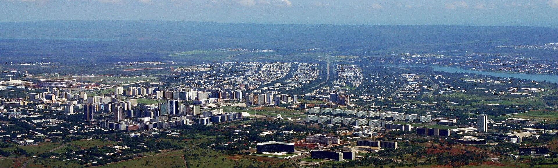
A local view near Brasília, Brazil
A local view near Brasília, Brazil. Photograph by Mariordo (Mario Roberto Duran Ortiz) · CC BY-SA 3.0 · Resized and converted to WebP.

THE SHORTLIST

A few places worth your time.

01Outdoors · DAY 1 IDEA

South Wing

City Park

With 4.2 km², it's slightly larger than New York City's Central Park. This wide green area is the city's hot spot for sports such as jogging, cycling, skating and even kart racing, as well as barbecues and other outdoor activities.

Allow about 60 minutes · planning estimate

Map Source
02Culture · DAY 1 IDEA

Av. W3 sul, quadra 702

Dom Bosco Church

A beautiful modern church built with concrete and blue stained glass. Bosco was a 19th-century Italian priest whose writings, some say, prophesied the creation of Brasilia. It's hard not to notice the huge crystal chandelier hanging from the ceiling in the middle of the square church.

Allow about 90 minutes · planning estimate

Map Source
03Culture · DAY 1 IDEA

Brasília

Television Tower

This used to be the best place for a sweeping panorama of the city, until the opening of the new Digital Tower. It's the second best now. There is also a crafts and typical food market at the base of the tower.

Allow about 90 minutes · planning estimate

Map Source
04Neighborhoods · DAY 2 IDEA

Brasília

Three Powers Square

Includes the seats of the country's 3 highest authorities: the Congress, the Presidential Palace (called Palácio do Planalto) and the Supreme Court. The axis itself is aligned such that on April 21 (Tiradentes Day, marking the death of the Brazilian independence martyr), the sun rises precisely between the two towers of Congress. The bronze statue of two abstract figures is named Os Candangos and represents the pioneering spirit of the workers who built the city.

Allow about 60 minutes · planning estimate

Map Source
05Culture · DAY 2 IDEA

Regional outing · 14 km from Brasília (straight line)

TV Digital Tower

Newest TV tower that was inaugurated on April 21, 2012. Designed by Niemeyer, one of his last works. It's tall, from which 120 m are a concrete structure, and the rest the metallic structure of the TV antenna. Two glass observatories complete the structure. The highest one, 80 m above the floor, will contain a restaurant with a panoramic view. The other one will be used as an art gallery.

Allow about 90 minutes · planning estimate

Map Source

A note before you go. Treat TV Digital Tower as a separate regional outing from Brasília. Arrange the outward and return journey before adding another visit on that day. The suggested days are an editable grouping, not a timed tour. Visit allowances exclude transfers, meals and queues; confirm the exact entrance and current visiting arrangements for TV Digital Tower before setting off.

Reference material retrieved 2026-10-19. Suggested days and time allowances are editorial starting points. Check the linked visitor information for opening hours, access, and reservations.

BEFORE YOU SET OFF

A more practical kind of plan.

Getting your bearings

Rent a car, ride the buses, take a cab, hitchhike, but whatever you do, don't plan on getting around Brasilia on foot. The city was designed under the assumption that every resident would own an automobile. Obviously things didn't turn out that way, and the city's public transport is a solution to an almost deliberately designed problem. Fortunately it works fairly well. Note that the roads have few crosswalks or traffic lights, so being a pedestrian also requires some caution and patience.

Build a route that makes sense

City Park and Dom Bosco Church are about 1.4 km apart in a straight line. Use the route link to compare the actual streets or transport connections before putting both in the same morning; the measurement is not a walking distance or a transfer estimate.

A LITTLE STRUCTURE. ROOM FOR DISCOVERY.

Your Brasília plan.

Add a few stops, choose your days, and leave space between them.

My saved trips
Location, map & reference details

Find your bearings.

Country
Brazil
Area
Federal District
Time zone
America/Sao_Paulo
Coordinates
-15.7797, -47.9297

Geographic reference: GeoNames, CC BY 4.0.

Brasília

Loading this map connects to OpenStreetMap.

Visitor information & sources

Reference credits & reuse

This city guide includes selected, abridged material by Wikivoyage contributors, adapted under CC BY-SA 4.0. The adapted guide text is available under the same license; photographs and website design retain their separate terms. Selected and abridged reference descriptions; operational prices and timetables omitted. Elsewhere added the shortlist, geographic grouping and planning notes.

Reference material retrieved 2026-10-19. It is community-edited background, not firsthand reporting or a live opening-hours service.

KEEP EXPLORING

More places in Brazil.

Browse the country
A WORLD OF POSSIBILITIES

Where to next?

Search 600 places across 100 countries.