North America / Canada

Montréal.

Places to go. A little room to wander.

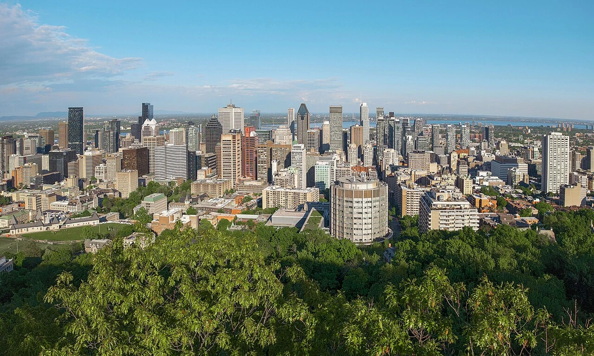
A local view near Montréal, Canada
A local view near Montréal, Canada. Photograph by Quintin Soloviev · CC BY 4.0 · Resized and converted to WebP.

THE SHORTLIST

A few places worth your time.

01Culture · DAY 1 IDEA

2900 boul Édouard-Montpetit

Université de Montréal

The second largest university in Canada in terms of students, Université de Montréal is a French speaking university whose campus is mostly concentrated on the mount Royal, between the metro stations Edouard-Montpetit and Côte-des-Neiges. The Roger-Gaudry building, with its tall tower and Art Deco architecture, is well worth a look. It is just in front of the metro station Université-de-Montréal.

Allow about 90 minutes · planning estimate

Map Source
02Culture · DAY 1 IDEA

3800 Chemin Queen Mary

St. Joseph's Oratory

The largest church in Canada, it has an impressive neo-Renaissance exterior and a contemporary bell tower. The Basilica has a beautiful, restrained, somewhat stark Art Deco interior, complete with unusual, elongated wooden statues of saints, and combined with the great height of its ceiling, it may seem somewhat forbidding, but it also has a more traditionally expressive series of statues of the Stations of the Cross and Crucifix at the altar and a pretty series of mosaics behind the altar.

Allow about 90 minutes · planning estimate

Map Source
03Neighborhoods · DAY 1 IDEA

rue Sainte-Catherine ouest at ave Wood

Westmount Square

A four-building complex composed of black metal and glass, built in 1967 and designed by Ludwig Mies van der Rohe.

Allow about 60 minutes · planning estimate

Map Source
04Culture · DAY 2 IDEA

2600 avenue Pierre-Dupuy

Habitat 67

This visually striking residential building was created by architect Moshe Safdie for Expo 67. The result was an amazingly modern dwelling that challenged the way architects created urban homes. Compared alternately to a beehive, a Taos pueblo, and a crystalline growth, the complex's 154 units are composed of prefabricated concrete cubes assembled on site. The apartments here are highly prized and a number of prominent Montrealers make Habitat 67 their home.

Allow about 90 minutes · planning estimate

Map Source
05Outdoors · DAY 2 IDEA

Montréal

Island of Poets

The Île aux poètes trail project aims to make poetry more accessible to the general public. In Rivière-des-Prairies-Pointe-aux-Trembles, Poets Island will take the form of benches set up in the borough's parks. These stone-filled banks from the banks of the St. Lawrence River, the Rivière des Prairies and Saint-Venant-de-Paquette are in symbiosis with nature and are places of contemplation. Plaques will be installed nearby, on which will be engraved poems of Montreal artists, from yesterday to today, in French and other languages.

Allow about 60 minutes · planning estimate

Map Source

A note before you go. Start with Université de Montréal, then decide whether St. Joseph's Oratory deserves a separate visit rather than rushing both. The suggested days are an editable grouping, not a timed tour. Visit allowances exclude transfers, meals and queues; confirm the exact entrance and current visiting arrangements for Island of Poets before setting off.

Reference material retrieved 2026-10-19. Suggested days and time allowances are editorial starting points. Check the linked visitor information for opening hours, access, and reservations.

BEFORE YOU SET OFF

A more practical kind of plan.

Getting your bearings

Montreal has historically been divided into east and west by boulevard Saint-Laurent, with the west side traditionally being Anglophone and the east side traditionally being Francophone. Numbered addresses on streets that cross Saint-Laurent start there and increase in either direction; most addresses are given as "rue ____ Ouest" (west) or "rue ____ Est" (east). Many streets are named after Catholic saints and figures from local history, both well-known and obscure. In Montreal street names, "east" and "west" refer to the direction parallel to the St. Lawrence River, and "north" and "south" refer to the direction perpendicular to the St.

Build a route that makes sense

Université de Montréal and St. Joseph's Oratory are about 1.5 km apart in a straight line. Use the route link to compare the actual streets or transport connections before putting both in the same morning; the measurement is not a walking distance or a transfer estimate.

A LITTLE STRUCTURE. ROOM FOR DISCOVERY.

Your Montréal plan.

Add a few stops, choose your days, and leave space between them.

My saved trips
Location, map & reference details

Find your bearings.

Country
Canada
Area
Quebec
Time zone
America/Toronto
Coordinates
45.5088, -73.5878

Geographic reference: GeoNames, CC BY 4.0.

Montréal

Loading this map connects to OpenStreetMap.

Visitor information & sources

Reference credits & reuse

This city guide includes selected, abridged material by Wikivoyage contributors, adapted under CC BY-SA 4.0. The adapted guide text is available under the same license; photographs and website design retain their separate terms. Selected and abridged reference descriptions; operational prices and timetables omitted. Elsewhere added the shortlist, geographic grouping and planning notes.

Reference material retrieved 2026-10-19. It is community-edited background, not firsthand reporting or a live opening-hours service.

KEEP EXPLORING

More places in Canada.

Browse the country
A WORLD OF POSSIBILITIES

Where to next?

Search 600 places across 100 countries.