North America / Canada

Ottawa.

Places to go. A little room to wander.

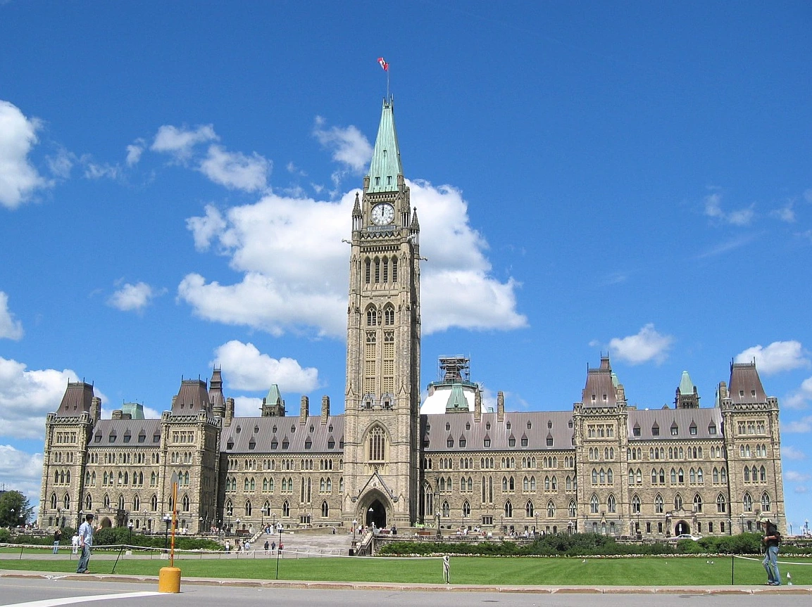
A local view near Ottawa, Canada
A local view near Ottawa, Canada. Photograph by No machine-readable author provided. Arctic.gnome assumed (based on copyright claims). · CC BY 2.5 · Resized and converted to WebP.

THE SHORTLIST

A few places worth your time.

01Culture · DAY 1 IDEA

Ottawa

Supreme Court of Canada

Canada's highest court and the best example in Ottawa of Art Deco architecture. Its marble Grand Entrance Hall is particularly impressive. The visit includes a tour in the Federal Court of Appeal and the Supreme Court of Canada hearing room. The visits last about 30 minutes and are provided by law students hired at the Court. The Court is a 5-minute walk from Parliament. Tours are offered in French on the half hour and in English on the hour. No reservations are needed between May 1 and August 30.

Allow about 90 minutes · planning estimate

Map Source
02Culture · DAY 1 IDEA

Alexandra Bridge

Kiwekì Point (formerly Nepean Point)

A quiet place to watch the sun set, or to take photos of Parliament Hill, the National Gallery, the Museum of History, and the Royal Canadian Mint from angles that don't usually end up in the tourist brochures. Kiwekì (pronounced key-WHECK-ee) Point is also home to a statue of Samuel de Champlain, and the Astrolabe Theatre (one of the better places to watch the fireworks from on July 1).

Allow about 90 minutes · planning estimate

Map Source
03Food · DAY 1 IDEA

861 Prince of Wales Dr

Canada Agriculture and Food Museum

A working animal farm in the city. You can visit animal barns, see various demonstrations and exhibitions, and ride on a horse-drawn wagon. The museum also has a playground and picnic area. It is very popular with young children and a welcome change of pace for kids who have seen enough history after visiting some of the other sights.

Allow about 60 minutes · planning estimate

Map Source
04Outdoors · DAY 2 IDEA

2960 Riverside Drive

Mooney's Bay Ski Centre

The city's trail system serves as an excellent cross-country ski trail system. The city-run ski centre at Mooney's Bay Park is a good starting point if you want classic cross country or skate skiing lessons or need to rent equipment. Trails along the Ottawa River (the Kichi Sibi Winter Trail or Britannia Winter Trail, Rideau River (the Rideau Winter Trail) are other public and scenic routes that are groomed and maintained by volunteers.

Allow about 60 minutes · planning estimate

Map Source
05Neighborhoods · DAY 2 IDEA

Regional outing · 27 km from Ottawa (straight line)

Cumberland Heritage Village Museum

A museum village featuring buildings from the early 20th century including a railway station.

Allow about 60 minutes · planning estimate

Map Source

A note before you go. Treat Cumberland Heritage Village Museum as a separate regional outing from Ottawa. Arrange the outward and return journey before adding another visit on that day. The suggested days are an editable grouping, not a timed tour. Visit allowances exclude transfers, meals and queues; confirm the exact entrance and current visiting arrangements for Cumberland Heritage Village Museum before setting off.

Reference material retrieved 2026-10-19. Suggested days and time allowances are editorial starting points. Check the linked visitor information for opening hours, access, and reservations.

BEFORE YOU SET OFF

A more practical kind of plan.

Getting your bearings

The O-Train Confederation Line runs east-west under the downtown area served by Lyon, Parliament, Rideau and uOttawa O-Train stations. If you are going to the Byward Market, get off at Rideau O-Train Station. OC Transpo has a webpage to look up schedules and maps for all the O-Train and bus routes mentioned above. It also has a Customer Service Centre on the 3rd floor of the Rideau Centre, above the corner of Rideau Street and Colonel By Drive in downtown Ottawa. There are others at major bus stations: Lincoln Fields in the west end, Place d'Orleans and St.

Build a route that makes sense

Supreme Court of Canada and Kiwekì Point (formerly Nepean Point) are about 0.9 km apart in a straight line. Use the route link to compare the actual streets or transport connections before putting both in the same morning; the measurement is not a walking distance or a transfer estimate.

A LITTLE STRUCTURE. ROOM FOR DISCOVERY.

Your Ottawa plan.

Add a few stops, choose your days, and leave space between them.

My saved trips
Location, map & reference details

Find your bearings.

Country
Canada
Area
Ontario
Time zone
America/Toronto
Coordinates
45.4112, -75.6981

Geographic reference: GeoNames, CC BY 4.0.

Ottawa

Loading this map connects to OpenStreetMap.

Visitor information & sources

Reference credits & reuse

This city guide includes selected, abridged material by Wikivoyage contributors, adapted under CC BY-SA 4.0. The adapted guide text is available under the same license; photographs and website design retain their separate terms. Selected and abridged reference descriptions; operational prices and timetables omitted. Elsewhere added the shortlist, geographic grouping and planning notes.

Reference material retrieved 2026-10-19. It is community-edited background, not firsthand reporting or a live opening-hours service.

KEEP EXPLORING

More places in Canada.

Browse the country
A WORLD OF POSSIBILITIES

Where to next?

Search 600 places across 100 countries.