North America / Guatemala

Flores.

Places to go. A little room to wander.

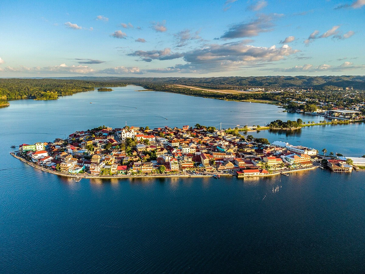
A local view near Flores, Guatemala
A local view near Flores, Guatemala. Photograph by Juan Francisco · CC BY-SA 2.0 · Resized proportionally to at most 1200 pixels wide without upscaling or a height limit; original ICC retained; EXIF orientation applied; converted to WebP high-quality photographic compression.

THE SHORTLIST

A few places worth your time.

01Culture · DAY 1 IDEA

Flores

Tayasal

Large overgrown Maya ruin a stone's throw from Flores, on the San Miguel peninsula just across the lake about 250 m distant. Easiest way to get there is by boat. Haggle with the lancheros, who will want to take you on a full (more expensive) tour of various sights. If archaeology is your thing, insist on only seeing the Tayasal ruins, and that the lanchero guide you to the major pyramids (all overgrown) - otherwise you might miss them on the forest trails.

Allow about 90 minutes · planning estimate

Map Source
02Culture · DAY 1 IDEA

Carr. a San miguel

Petencito Zoo

A small zoo that is home to monkeys, jaguars and raccoons as well as some animals rescued by ARCAS. The zoo is a 10-minute boat ride from Flores (inquire behind Hotel Santana).

Allow about 90 minutes · planning estimate

Map Source
03Culture · DAY 1 IDEA

Flores

Ak'tun Kan

Inside the cave are many formations that resemble various objects, such as animals, people, and of course ordinary stalagmites and stalactites. Most of the relics are labeled (in Spanish) and will be identified by your guide.

Allow about 90 minutes · planning estimate

Map Source
04Outdoors · DAY 2 IDEA

km 468 (Via Rio Dulce to Flores, Petén)

Ixpanpajul Natural Park

Ixpanpajul is a natural park that is a 15-minute ride away from the island of Flores in Petén. The organisation of Ixpanpajul has a pick-up service from Flores or Santa Elena that takes you quickly to the park, to experience the great activities in the great wild forests typical of Guatemala. The activities to be experienced are swinging through the forests on a Zip-Line, taking a walk on the Sky-Way and going horseback riding. Larger groups are given discount rates.

Allow about 60 minutes · planning estimate

Map Source
05Culture · DAY 2 IDEA

Flores

El Mirador

Hike to the ruins of El Mirador near the Mexican border. This ancient Maya city was once home to hundreds of thousands of people and has the highest pyramid of all Mayan cities of about 70 m. The site is covered by vegetation and excavation is still going on. Prepare for a 17km hike to the ruins of Tintal on day one, 23km to El Mirador on day two, one day at the site and then all the way back through dense jungle. A tour can be organized in Flores.

Allow about 90 minutes · planning estimate

Map Source

A note before you go. Start with Tayasal, then decide whether Petencito Zoo deserves a separate visit rather than rushing both. The suggested days are an editable grouping, not a timed tour. Visit allowances exclude transfers, meals and queues; confirm the exact entrance and current visiting arrangements for El Mirador before setting off.

Reference material retrieved 2026-10-19. Suggested days and time allowances are editorial starting points. Check the linked visitor information for opening hours, access, and reservations.

BEFORE YOU SET OFF

A more practical kind of plan.

Getting your bearings

Walking is the most common way to get around, and circling the whole island takes about 15 minutes. It is an easy walk to Santa Elena and San Benito from Flores, about 10 minutes along the sidewalks of the causeway. Otherwise, auto-rickshaws (tuk-tuks), vans and buses are an option. Rates also go up at night. The towns of San José and San Andrés, located on the northern shores of the lake, can be reached by hiring an expensive boat.

Build a route that makes sense

Tayasal and Petencito Zoo are about 2.5 km apart in a straight line. Use the route link to compare the actual streets or transport connections before putting both in the same morning; the measurement is not a walking distance or a transfer estimate.

A LITTLE STRUCTURE. ROOM FOR DISCOVERY.

Your Flores plan.

Add a few stops, choose your days, and leave space between them.

My saved trips
Location, map & reference details

Find your bearings.

Country
Guatemala
Area
Petén
Time zone
America/Guatemala
Coordinates
16.9226, -89.8994

Geographic reference: GeoNames, CC BY 4.0.

Flores

Loading this map connects to OpenStreetMap.

Visitor information & sources

Reference credits & reuse

This city guide includes selected, abridged material by Wikivoyage contributors, adapted under CC BY-SA 4.0. The adapted guide text is available under the same license; photographs and website design retain their separate terms. Selected and abridged reference descriptions; operational prices and timetables omitted. Elsewhere added the shortlist, geographic grouping and planning notes.

Reference material retrieved 2026-10-19. It is community-edited background, not firsthand reporting or a live opening-hours service.

KEEP EXPLORING

More places in Guatemala.

Browse the country
A WORLD OF POSSIBILITIES

Where to next?

Search 600 places across 100 countries.