Europe / Ireland

Galway.

Places to go. A little room to wander.

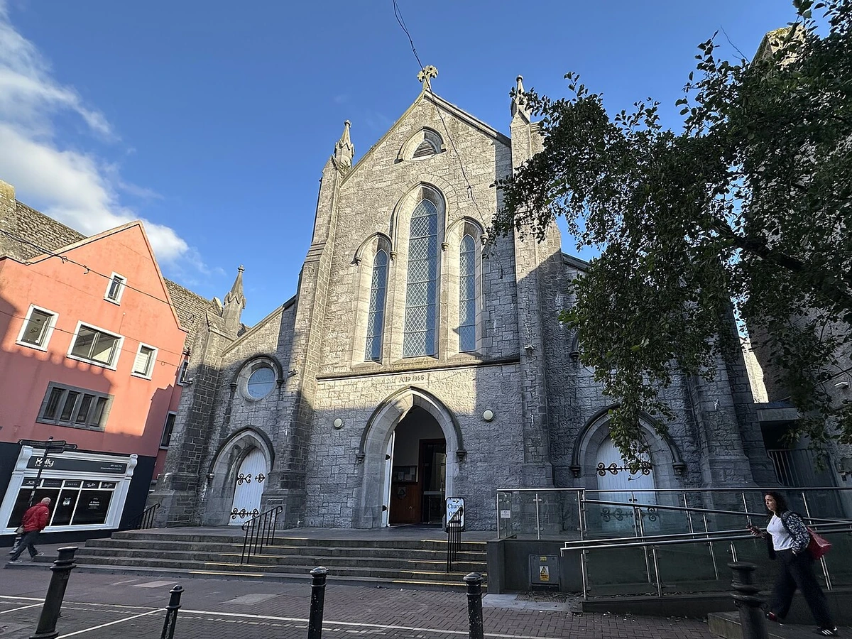
A local view near Galway, Ireland
A local view near Galway, Ireland. Photograph by Thoslee · CC BY-SA 4.0 · Resized proportionally to at most 1200 pixels wide without upscaling or a height limit; original ICC retained; EXIF orientation applied; converted to WebP high-quality photographic compression.

THE SHORTLIST

A few places worth your time.

01Culture · DAY 1 IDEA

26 Shop Street H91 E653

Legend of the Claddagh Ring

Called a museum but mostly a marketing exercise. The Claddagh Ring is a style of mani in fede finger ring: two hands join to clasp a heart. It's been a design for wedding or engagement rings since medieval times but became a Galway tradition from 1700, when the jewellers worked near an Claddagh, the city shore. It became popular from the late 20th century, and legends were embellished around it as ingeniously as its designs.

Allow about 90 minutes · planning estimate

Map Source
02Culture · DAY 1 IDEA

Druid Lane

Hall of the Red Earl

The Hall is the earliest medieval structure to be seen within the walls of the city. It was built by the de Burgo family in the 13th century and was the main municipal building, acting as town hall, court house and tax collection office. Only a fragment remains, protected behind glass, and it won't take a minute to see. The modern building adjoining is the base of Galway Civic Trust, and their guided walks through the city start here, see below.

Allow about 90 minutes · planning estimate

Map Source
03Culture · DAY 1 IDEA

Galway

University Quad

This was the original quadrangle of the college that opened in 1849 and became one of the three colleges of Queens University of Ireland, the others being Belfast and Cork. The Quad buildings are in mock Tudor Gothic modelled on Oxford's Christ Church, so their aspirations are clear. They're nowadays the admin offices of a huge modern campus stretching from the river and canal to Newcastle Road, then continuing west as University Hospital.

Allow about 90 minutes · planning estimate

Map Source
04Outdoors · DAY 2 IDEA

Galway

River Corrib

flows for 6 km south from Lough Corrib to enter Galway Bay. In 1178 the friars of Clairegalway cut a new channel out of the lough, east of the original outflow, and this became the main course of the river. The last km of river is a fast descent, great for driving waterwheels but not navigable. Eglinton Canal was cut just west of the cathedral in the 19th century to bypass that last km, with swing bridges, locks, and side-races for mills. The bridges are now fixed so the canal is no longer navigable except by kayak.

Allow about 60 minutes · planning estimate

Map Source
05Neighborhoods · DAY 2 IDEA

Galway

William Street

southwest off the square is the historic spine of the city, becoming William Street then Shop Street then High Street then Quay Street. It's all pedestrianised, an agreeable stroll from park to pub to pub to eating place to pub. At the top of Shop Street, Lynch's Castle is a fine medieval town house, once home to the Lynch dynasty.

Allow about 60 minutes · planning estimate

Map Source

A note before you go. Start with Legend of the Claddagh Ring, then decide whether Hall of the Red Earl deserves a separate visit rather than rushing both. The suggested days are an editable grouping, not a timed tour. Visit allowances exclude transfers, meals and queues; confirm the exact entrance and current visiting arrangements for William Street before setting off.

Reference material retrieved 2026-10-19. Suggested days and time allowances are editorial starting points. Check the linked visitor information for opening hours, access, and reservations.

BEFORE YOU SET OFF

A more practical kind of plan.

Getting your bearings

Walk: Central Galway is easily accessible on foot, and Salthill is a pleasant 30-minute walk from the centre, down the Prom to Blackrock. Taxis: there are ranks in Eyre Square and Bridge Street. You can use the TFI website to calculate rates. Bike: TFI Bikes operates bike share in Galway. The pass includes unlimited 30-minute journeys, and reasonably priced amounts for longer rides. While drivers are fairly considerate of bicycles, there is limited bicycle-specific infrastructure in the city. Try not to bring a car into town, it's congested and has limited, expensive parking.

Build a route that makes sense

Legend of the Claddagh Ring and Hall of the Red Earl are about 0.2 km apart in a straight line. Use the route link to compare the actual streets or transport connections before putting both in the same morning; the measurement is not a walking distance or a transfer estimate.

A LITTLE STRUCTURE. ROOM FOR DISCOVERY.

Your Galway plan.

Add a few stops, choose your days, and leave space between them.

My saved trips
Location, map & reference details

Find your bearings.

Country
Ireland
Area
Connacht
Time zone
Europe/Dublin
Coordinates
53.2724, -9.0510

Geographic reference: GeoNames, CC BY 4.0.

Galway

Loading this map connects to OpenStreetMap.

Visitor information & sources

Reference credits & reuse

This city guide includes selected, abridged material by Wikivoyage contributors, adapted under CC BY-SA 4.0. The adapted guide text is available under the same license; photographs and website design retain their separate terms. Selected and abridged reference descriptions; operational prices and timetables omitted. Elsewhere added the shortlist, geographic grouping and planning notes.

Reference material retrieved 2026-10-19. It is community-edited background, not firsthand reporting or a live opening-hours service.

KEEP EXPLORING

More places in Ireland.

Browse the country
A WORLD OF POSSIBILITIES

Where to next?

Search 600 places across 100 countries.