Asia / Nepal

Pokhara.

Places to go. A little room to wander.

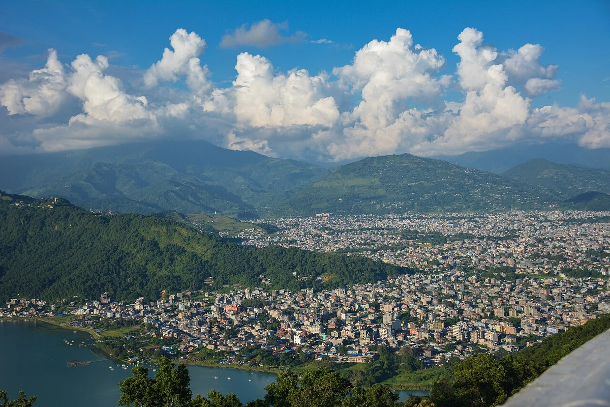
A local view near Pokhara, Nepal
A local view near Pokhara, Nepal. Photograph by Utsab Raj Giri · CC BY-SA 4.0 · Resized proportionally to at most 1200 pixels wide without upscaling or a height limit; original ICC retained; EXIF orientation applied; converted to WebP high-quality photographic compression.

THE SHORTLIST

A few places worth your time.

01Culture · DAY 1 IDEA

Pokhara

Sarangkot

The perfect pre-trek warm-up. Head up Sarangkot, and be prepared as it's steep and hard work. You can rent a motor bike or use the cable car to go to the top. The road is rough, but traversable. Great views, spectacular images and a great way to get a taste of what it's like to be trekking.The Sarangkot south slope trail is a challenging run/polewalk workout. Go north through Lakeside about 5 km, through Kare until cable car bottom station.

Allow about 90 minutes · planning estimate

Map Source
02Outdoors · DAY 1 IDEA

Pokhara

Phewa/Fewa Lake (Phewa/Fewa Tal)

One of Nepal's most beautiful spots, Phewa Tal is surrounded by a combination of monkey-filled forests and high white peaks. The reflections in the mirror-like water in the early mornings are impressive. Hire a boat and row yourself across the lake, or hire a local to do it for you – there are some fine times to be had on this lake, even in the middle of the night.

Allow about 60 minutes · planning estimate

Map Source
03Culture · DAY 1 IDEA

Pokhara

World Peace Pagoda (Shanti Stupa)

Opened in 1999 on top of a hill just south of Phewa Tal, the Stupa offers great views of the Annapurna Mountains, including Fishtail, Dhaulagiri, Annapurna South, and Annapurna III. This is a great place to watch the sunrise or sunset over Pokhara. The easiest way to get there is to take a taxi to the base of the Peace Pagoda (Rs1000 return, including waiting).

Allow about 90 minutes · planning estimate

Map Source
04Culture · DAY 2 IDEA

Pokhara

Kahun Dharahara

Kahun is the second nearest hill close to the city. At the top of Kahun there's a view tower locally called "Kahun Dharhara". You can get there by bus, motorbike or cycle. Hiking also shouldn't take more than 2½ hours to reach there from Ranipauwa. A spectacular view of Annapurna range can be seen straight from the tower. The Pokhara valley can also be observed.

Allow about 90 minutes · planning estimate

Map Source
05Outdoors · DAY 2 IDEA

Regional outing · 17 km from Pokhara (straight line)

Begnas Lake (Begnas Tal)

Out of town and away from the hustle, Begnas Tal is quiet, clean and peaceful. There are a few basic hotels nearby and the odd refreshment shop. A very nice Vipassana Meditation Retreat is also here, one of many around the world. The walk along the road leading to Begnas Tal is fascinating; the seasonal rhythms of daily life in the country make great images.

Allow about 60 minutes · planning estimate

Map Source

A note before you go. Treat Begnas Lake (Begnas Tal) as a separate regional outing from Pokhara. Arrange the outward and return journey before adding another visit on that day. The suggested days are an editable grouping, not a timed tour. Visit allowances exclude transfers, meals and queues; confirm the exact entrance and current visiting arrangements for Begnas Lake (Begnas Tal) before setting off.

Reference material retrieved 2026-10-19. Suggested days and time allowances are editorial starting points. Check the linked visitor information for opening hours, access, and reservations.

BEFORE YOU SET OFF

A more practical kind of plan.

Build a route that makes sense

Sarangkot and Phewa/Fewa Lake (Phewa/Fewa Tal) are about 4.0 km apart in a straight line. Use the route link to compare the actual streets or transport connections before putting both in the same morning; the measurement is not a walking distance or a transfer estimate.

A LITTLE STRUCTURE. ROOM FOR DISCOVERY.

Your Pokhara plan.

Add a few stops, choose your days, and leave space between them.

My saved trips
Location, map & reference details

Find your bearings.

Country
Nepal
Area
Gandaki Pradesh
Time zone
Asia/Kathmandu
Coordinates
28.2669, 83.9685

Geographic reference: GeoNames, CC BY 4.0.

Pokhara

Loading this map connects to OpenStreetMap.

Visitor information & sources

Reference credits & reuse

This city guide includes selected, abridged material by Wikivoyage contributors, adapted under CC BY-SA 4.0. The adapted guide text is available under the same license; photographs and website design retain their separate terms. Selected and abridged reference descriptions; operational prices and timetables omitted. Elsewhere added the shortlist, geographic grouping and planning notes.

Reference material retrieved 2026-10-19. It is community-edited background, not firsthand reporting or a live opening-hours service.

KEEP EXPLORING

More places in Nepal.

Browse the country
A WORLD OF POSSIBILITIES

Where to next?

Search 600 places across 100 countries.