
Make this your Singapore itinerary
THE SHORT VERSION
- Choose a manageable Mount Faber–Henderson Waves section.
- Verify NParks notices before adding a connecting path.
- Treat humidity and stairs as part of the walking distance.
Pick a section you will enjoy finishing
Singapore’s greenery becomes more convincing when you leave the postcard garden for an ordinary walking day. The Southern Ridges offer a way to see how wooded hills and pedestrian connections sit above busy roads and neighborhoods. You do not have to complete every linked park. I would choose a section around Mount Faber and Henderson Waves, then decide whether to extend only after checking conditions and how everyone feels.
The route needs a little more thought than a waterfront promenade. Hills, stairs, exposed sections, and humid air all affect the effort. Mark the entrance, a realistic turnaround, and a way out before setting off. The best short walk has a satisfying focus; Henderson Waves can provide that without becoming an excuse to continue far beyond the distance you wanted.
Notice the change in layers
Approaching the ridge, look at how the city changes around you. Traffic remains audible, but trees begin to shape the view and the ground becomes more important than the next shopfront. Let that transition be part of the outing. It is tempting to keep checking a map for the next named feature, yet the connections between those features explain why the walk is worthwhile.
Take stairs and slopes at a pace that leaves room to look. If you have come with someone who walks more slowly, stop together at a useful viewpoint rather than repeatedly marching ahead and waiting impatiently. A shared walking day is more pleasant when the route fits the group. There are plenty of other ways to make an afternoon active without turning a humid climb into a test.
Let Henderson Waves be more than a crossing
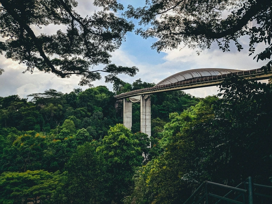
Henderson Waves links the hill parks with a timber-decked pedestrian structure whose curved form invites a closer look. The interesting detail is how circulation and places to pause fit together. Walk across once to understand its shape, then choose a suitable spot to stop without blocking others. The bridge gives you a chance to compare the canopy at eye level with the city below.
Avoid leaning over barriers or using railings as seating. Keep food away from wildlife, and do not approach an animal to improve a picture. The greenery is not simply decorative scenery surrounding the bridge; it is habitat threaded through a highly developed city. Watching from a distance is more rewarding than creating the movement you then try to photograph.
Make the extension a decision, not a default
If you want to continue toward Telok Blangah Hill Park or farther connections, consult the current NParks map and notices. Boardwalks and linking sections can close, and an older route description may not reflect the day’s options. Look at the terrain between named points rather than adding distances as if every kilometer were flat. Turning around while the walk still feels good is a sensible choice.
Finish with a meal away from the ridge if that suits your exit. A familiar transit stop and somewhere to sit can be a better conclusion than one last viewpoint reached with an empty water bottle. Take a minute to look back at the green line above the roads. Seeing where you walked helps make sense of a city whose parks are often discussed individually even though their connections are part of the experience.
Choose the bridge, then choose the way down
For a first Southern Ridges outing, I would put Henderson Waves at the center of the map and work outward. Choose an approach through Mount Faber or Telok Blangah that fits the effort you want, then identify a practical exit before adding another park. This is more useful than copying a route designed to cover every linked section. A bridge crossing and a hill-park walk already provide a recognizable afternoon. A farther connection should offer something you specifically want, such as another landscape type, not merely another name to tick off.
The approach deserves a closer look than the headline distance. Some options use stairs or sustained slopes, and humidity can make them feel different from a similar climb in a cooler city. Check the full route if anyone needs a gentler or step-free approach. The fact that a bridge deck accommodates wheels does not tell you whether your selected entrance is suitable. Ask about the complete journey, including the way back down. This avoids the discouraging experience of finding a perfectly comfortable destination beyond an approach your group cannot comfortably manage.
At Henderson Waves, notice the distinction between the through-route and the places intended for pausing. The curved structure offers a chance to look at canopy and city from a new level, but it remains a connection used by other walkers. Choose a recess where you can stop without creating a bottleneck. Looking in several directions is more informative than making the same centerline photograph repeatedly. You might compare the texture of the timber, the line of the bridge, and the greenery immediately below it. Follow all posted guidance about use and access.
Before moving toward another section, check the current NParks notices rather than relying only on a printed walking guide. A maintenance closure can change the logic of a long route, particularly if your intended exit depends on the connecting path. If the next leg is open, ask whether you still have enough water and interest to enjoy it. Extending because a route exists is not the same as extending because the landscape appeals. A cooler, shorter visit often leaves a clearer memory than a long humid walk undertaken to justify the journey.
For the finish, decide where the greenery should give way to a meal or transit stop. Mark that route while you can still compare options calmly. If thunder develops, do not linger on an exposed elevated section for a dramatic image; follow local guidance toward an appropriate exit and shelter. On a fine day, use the descent to notice how quickly roads and neighborhood activity return. That transition is one of the most interesting parts of the walk. The ridges do not remove you from Singapore; they let you see how a different layer of it connects.
A shorter first visit
For someone unsure about the hills, a deliberately short Henderson Waves outing can be a good introduction. Confirm a suitable approach, cross the bridge, spend time looking at the canopy, and leave by the route you assessed in advance. This still shows how elevated pedestrian space connects green areas across the urban landscape. You can investigate HortPark or another section later with a different starting point. Keeping the first route small also makes it easier to notice surfaces and gradients that matter to your own comfort. Your second visit can then be planned from experience rather than from an impressive total distance on a tourism map.
Sources & further reading
First published 18 October 2026. Page updated 19 October 2026. Planning references checked on 18 October 2026. The edition date above follows your device’s time zone; it does not indicate a new research check. Confirm current opening details and booking arrangements with the places you plan to visit.